West Papua tour guide Adventure


West Papua forms the western half of the large island widely known as New Guinea. Administratively part of Indonesia, West Papua is officially known as Irian Jaya.

To experience West Papua is to embark on a voyage into one of humanity’s deepest mysteries. This far-away and little known island lies like a curled infant in the lap of Mother Nature.

West Papua is home to the most ethnologically primitive cultures on Earth. No less than 25% of the world’s languages are spoken here and obviously you will find a vast display of tribes and tribal customs. These are people largely unaffected by the strictures of the modern world as we know it; a race adapted to daily life solely through their basic survival elements.

The land of the Papuans is home to an incredibly diverse, rich and unique flora and fauna. No less than 85% of the island is covered by rainforest, much if it primary and untouched by man. Other prevailing ecosystems include steamy mangrove forest and savannah right through to alpine highlands with snow-capped mountains. Wildlife abounds and includes some of the most interesting creatures known to man. This also holds true with the magical beauty of West Papua’s coastal underwater world, which hosts some truly amazing coral reefs.

Our singular appreciation and understanding of this island not only allows you the opportunity to visit and appreciate this most primitive of lands, but we also present you with the opportunity to experience and explore a completely unique human reality which can deepen your own sense of being and purpose. Root cultures such as those found in Papua hold an appreciation of deep earth secrets that can be shared only through direct experience. These are humans intrinsically interwoven with the natural fabric of their environment.

Many parts of West Papua still remain largely unexplored by peering, inquisitive western eyes and minds. For example, it has only been around 60 years since the outside world fell upon the tribes that inhabit the Baliem Valley in West Papua. The Korowai tribes were only discovered 25 years ago and other areas remain completely unexplored.

There remains a tremendous gap between those of us raised in western society and the most primitive people still alive on earth. If you are an individual who enjoys the exploration of this mysterious human condition you would certainly find a visit to West Papua immensely rewarding. Equally, if you simply enjoy and appreciate environments totally different from your own, then West Papua is surely for you.

Maluku-Manusela National Park


ID Seram.PNG

Image via Wikipedia

Marsegu Island was located at west side of Seram Island (Nusa Ina / Ibu Island) which famous with its Taman Nasional Manusela (National Park Manusela). Marsegu island was at West Seram regency, Province of Maluku. Local people named this island as Marsegu because it has so many bats in there. Marsegu come from the local language means bat.

May be if you hear bats, the first thing that crossing in your mind could be Dracula, a man who suck your blood and can change his body into bat. But, this island was not terrifying at all. In fact, many the gifts of nature and gorgeous sceneries you can see in here, as place for recreation or place for botanical ocean research.

Marsegu IslandBesides bats, you also can see protected species suach as Gosong Megaphodius reinwardtii (Burung Maleo/bird) and coconut crab (Birgus latro) or local people say “kepiting kenari“. There are many other birds which make this island as a place for finding food, for play or for sleep.

Marsegu Island or “the bat island” was part of the protected forest area which established by Keputusan Menteri Kehutanan Nomor: 10327/Kpts-II/2002, in December 30th 2002; It has 240.20 Ha wide. The sea area was part of Taman Wisata Alam Laut (Ocean Park Trip) with 10,000 Ha wide, established by SK Menhutbun No. 114/Kpts-II/1999, in March 5th 1999. This area has a very potent ocean resource, many colorful coral and flora and fauna in different shape and size available here.

FishFor you who love seafood, all you can eat is available! You can get the seafood by fishing your self or buy from the fisherman. You can choose what ever fish you like and cook it with your own way, whether roast, burn, fry or other way.

In Marsegu, you can see some forests, one of them was secondary jungle which created by people as land for farming. This secondary forest community was growth on a coral stage by stage in weathering process. Previously, this area was a primer forest with trees diameter more than 100 cm.

Half of this island was mangrove forest, which contains mangrove species such as Rhizophora mucronata, Rhizophora apiculata, Brugueira gymnorrhiza, Brugueira sexangula, Ceriops tagal, Xylocarpus mollucensis, Xylocarpus granatum, Heritiera littoralis, Lumnitzera littorea, Aegiceras corniculatum, Excoecaria agallocha, Pemphis acidula and Scyphiphora hydrophyllacea.

Marsegu Island
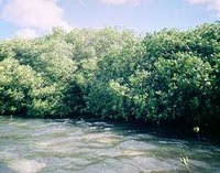
The most outside zone of the mangrove area is Rhizophora mucronata which then mingled with Rhizophora apiculata and at the middle is Brugueira gymnorrhiza, Brugueira sexangula, Ceriops tagal, Xylocarpus mollucensis and Xylocarpus granatum. Well, here you can find the peacefulness which can’t be found in your neighborhood.

At the east side of Marsegu island, there is jungle beach vegetation which has white sand throughout 1600 meters. Type of vegetation in this zone is Cordia subcordata, Pongamia pinnata, Terminalia catappa and Baringtonia asiatica.

While at the north side of white sand beach, you can find Ipomea pescaprae zone which dominated by rumput angin (Spinifex littoreus) and Katang-katang (Ipomea pescaprae). This location is suitable as tourist area. The ocean scenery is very beautiful and you can heal the fresh ocean air.

Marsegu Island
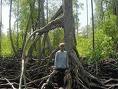
For you who want to camp or leave for a couple days, there are two wells as fresh water sources which used by people surrounding the wells to drink, take a bath and washing.

So, you don’t have to doubt to visit this exotic location. Well, start to make a plan to trip to Marsegu Island, guarantee you’ll be satisfied and have an unforgettable adventure.

Sulawesi Discover tour-bunaken-Toraja land


Bunaken National Marine Park, Manado, Indonesia

Image via Wikipedia

SOUTH SULAWESI
Sulawesi is orchid-shaped island once famous on million of classroom maps as celebes,its coastal outline is a natural simbol for the island’s undeniable flowering beauty.In the south are Shimmering  hot spring,myriad – coloured sea shell adn butterflies.In the main city of Ujung Pandang [Nakassar] live the adventourous Buginese seafarers whos tall sailing ship have centuries for conquered  the waves.Hidden 300 miles north is the green and yellow country of Tana Toraja.The land of the heavenly King and hanging graves.Where the mountain people dwell in prow-shaped houses and perform burrial ceremonies whose elaborate richness rivals even that of Bali.
NORTH SULAWESI
The fables of the south seas come to life in the northeastern arm of Sulawesi withits  endless white sandy beaches.volcanic,mountain and lakes.the whealth of coconut and clove plantations contibute tothe galety of thes friendly people.known for its coral reefs in un polluted sea.The hues of marine life is a driver’s dream.Minahasa,Bollaang Mongondow,Gorontalo and sangir Talaud,each it with its own culture and traditions tellof a pass tribal gathering and clanish lifestyle. 

Tour Destination
BUNAKEN
The paradise of Scuba Divers
Bunaken is part of the Bunaken National Marine Park, which has some of the highest levels of marine biodiversity in the world.[ Scuba diving attracts many visitors to the island. Bunaken is located at the north of the island of Sulawesi, Indonesia.1,5  hrs ride fast boat It belongs administratively to the municipality of Manado. 

The Bunaken National Marine Park was formally established in 1991 and is among the first of Indonesia’s growing system of marine parks. The park covers a total surface area of 890.65 km², 97% of which is overlain by sparkling clear, warm tropical water. The remaining 3% of the park is terrestrial, including the five islands of Bunaken, Manado Tua, Mantehage, Nain and Siladen. Although each of these islands has a special character, it is the aquatic ecosystem that attracts most naturalists.

The waters of Bunaken National Marine Park are extremely deep (1566 m in Manado Bay), clear (up to 35-40 m visibility), refreshing in temperature (27 to 29 °C) Pick any of group of interest – corals, fish, echinoderms or sponges – and the number of families, genera or species is bound to be astonishingly high. For example, 7 of the 8 species of giant clams that occur in the world, occur in Bunaken. The park has around 70 genera of corals; compare this to a mere 10 in Hawaii. Although the exact number of fish species is unknown, it may be slightly higher than in the Philippines, where 2,500 species, or nearly 70% of all fish species known to the Indo-western Pacific, are found.

Other sides of Bunaken.

Oceanic currents may explain, in part, why Bunaken National Marine Park is such a treasure trove of biodiversity. Northeasternly currents generally sweep through the park but abundant counter currents and gyros related to lunar cycles are believed to be a trap for free swimming larvae. This is particularly true on the south side of the crescent-shaped Bunaken Island, lying in the heart of the park. A snorkler or diver in the vicinity of Lekuan or Fukui may spot over 33 species of butterfly fish and numerous types of groupers, damsels, wrasses and gobies. The gobies, smallish fish with bulging eyes and modified fins that allow them to attach to hard surfaces, are the most diverse but least known group of fish in the park.

Biologists believe that the abundance of hard corals is crucial in maintaining the high levels of diversity in the park. Hard corals are the architects of the reefs, without them, numerous marine organisms would be homeless and hungry. Many species of fish are closely associated with particular types of corals (folious, branching, massives, etc.) for shelter and egg-laying. Others, like the enormous Bumphead Parrotfish, Balbometopon muricatum, are “coralivores” and depend on hard corals for their sustenance. Bony mouth parts fused into an impressive “beak” allow these gregarious fish to crunch corals like roasted peanuts.

Some 20,000 people live on the natural resources of Bunaken National Marine Park. Although there are inevitable conflicts between resource protection and use by people, the Indonesian government is taking a fairly unusual and pragmatic approach to park management. The idea is to promote wise resource use while preventing overexploitation. Local communities, government officials, dive resort operators, local nature groups, tourists and scientists have played an active role in developing exclusive zones for diving, wood collection, fishing and other forms of utilization. Bunaken Marine Park has become an important example of how Sulawesi, and the rest of Indonesia, can work to protect its natural resources.

WAKATOBI
Wakatobi is the name of an archipelago located in an area of Sulawesi Tenggara (South Eastern), Indonesia. The name Wakatobi is derived from the names of the main islands that form the archipelago: Wangiwangi Island, Kaledupa, Tomea, and Binongko. The group is part of a larger group called the Tukangbesi Islands. The archipelago, located in the biodiverse hotspot known as Wallacea.

The Wakatobi is also home to Operation Wallacea, a UK based for non-profit conservation group looking at sustainable development of fisheries and coral reef research. An independent non-commercial website [1] has been set up about the marine park. This website contains tourist and travel information about the wakatobi, with additional resources about the biodiversity, conservation and local people.

SOUTH SULAWESI TOUR PACKAGES

Toraja – South Sulawesi

Toraja traditional houses
Situated at the crossroads of strategic sea-lanes steeped in history, the province of South Sulawesi consists of the narrow southwestern peninsula of this mountainous, orchid-shaped island. The capital and chief trading port, Makassar, is still the gateway to eastern Indonesia. 

Spanish and Portuguese galleons, followed by British and Dutch traders, sailed these seas In search of the spice trade, escorted by their Men-of-War to protect them from the daring raids of the Bugis and Makassar pirates. Famed for their seafaring culture, the Bugis are still the driving force behind the world’s last commercial sailing fleet. Bugis vessels have sailed as far as Australia, leaving behind images of their ships carved in stone, and Bugis words which were integrated into the Aboriginal language of northern Australia.

The seafaring Bugis dominate the southern tip of Sulawesi, but in the rugged and remarkable country further north is Tana Toraja, often referred to as the “Land of the Heavenly Kings”. The traditional culture of the Torajans rivals any in the archipelago, making this area one of the most popular tourist destinations in Indonesia.

Toraja

Believing that their forefathers descended from heaven in a boat some twenty generations ago, the Torajans have a unique Christian animist culture .the majority of the people still follow an ancestral cult called “Aluk Todolo”, which governs all traditional ceremonies. Their ancestor worship includes elaborate death and after life ceremonies, which are essentially great feasts. A strict social hierarchy is followed in the villages, and for an important figure wedding and burial ceremonies can take days to perform. Water buffalo and pigs are sacrificed in numbers appropriate to social rank, and the deceased’s remains are placed in a coffin and interred in caves hollowed out in high cliffs. The mouth of the cave is guarded by lifelike statues, called Tau Tau, who look out from a balcony near the burial caves, watching over the families and friends they have left behind. 

Tongkonan, the family houses, are built on stilts with the roof rearing up at either end, representing the prows of the first ship to arrive in the area with the Torajan ancestors. The houses all face north and some say that this is because it was from the north that the ancestors of the Toraja came. Others however will say that the north (and east) is regarded as the realm of the gods, on the compass of life.

South Sulawesi is also famous for its tremendous scenery and the quality and talent of its silk and silverwork industries, but the economy is largely based on agriculture.

The provincial capital of Makassar, formerly Ujung Pandang, is easily accessible by air. There are daily flights from Jakarta, Bali, Surabaya and Manado.

Toraja Toraja Old lady making thread

TORAJA TOUR – 4 Days/3 Nights

Day 01 Meeting services at Hasanuddin Airport Makassar, afterwards, set out on the picturesque drive to Toraja. Lunch at a seafood restaurant in Pare-Pare. In the afternoon stop will be made at Puncak Lakawan to enjoy the spectacular view. Late in the afternoon arrival Rantepao. Dinner and overnight in the Heritage Hotel.
Day 02 After breakfast, we will take you on a full day excursion in Toraja, in the morning we will visit Lemo, where we will find rows of Tau-Tau and the hanging graves. Londa has an ancient natural grave where the deceased are entombed with big ceremonies. Kete-Kesu is a traditional Torajan Village, where we can see the Tongkonan and the old rice barns and it is famous for its woodcarving. Lunch is served in Rantepao. Dinner and overnight in Heritage Hotel.
Day 03 After breakfast, we make another full day excursion in Toraja. Today we visit Pallawa, Sa’dan (the weaving center), Marante and Nanggala, a traditional Torajan village, known for its large Tongkonan and 14 rice barns. Lunch is served in Rantepao. Dinner and overnight in Heritage Hotel.
Day 04 After breakfast transfer back to Makassar. Lunch will be served in Pare-Pare. Afterwards transfer directly to Hasanuddin Airport for your next destination.

Borneo -Dayak tour-Orang utan


KALIMANTAN

Since the eighteenth century, the central region of Kalimantan and its Dayak inhabitants were ruled by the Muslim Sultanate of Banjar. Following Indonesian independence after World War II, Dayak tribes demanded a province separate from South Kalimantan province.In 1957, South Kalimantan was thus divided to provide the Dayak population greater autonomy from the Muslim population in that province. It was approved by the Indonesian Government on 23 May 1957 under Presidential Law No. 10 Year 1957, which declared Central Kalimantan the seventeenth province of Indonesia. President Sukarno appointed the Dayak-born national hero Tjilik Riwut as the first Governor and Palangka Raya the provincial capital.
The three major Dayak tribes in Central Kalimantan are the Ngaju, Ot Danum and Dusun Ma’anyan Ot Siang. The three major tribes extended into several branches of prominent Dayak tribes in Central Kalimantan such as Lawangan, Taboyan, Dusun Siang, Boyan, Bantian, Dohoi and Kodorin. 

In addition to the indigenous Dayak tribes, the province also groups from other areas of Indonesia, including Javanese, Maduranese, Batak, Toraja, Ambonese, Bugis, Palembang, Minang, Banjarese, Makassar, Papuan, Balinese, Acehnese and also Chinese.
TOUR PACKAGES


Orangutan wildlife & Dayak Culture Tour
Duration :5 Days – 4 Nights
Starting Daily
Highlight : Orangutan feeding time, proboscis monkey, River safari, Dayak Culture and tradition
Start and Finish : Pangkalan Bun
Flight Information

ITINERARY
DAY 01 : PANGKALAN BUN – ORANGUTAN
Upon arrival at Pangkalan Bun Airport meeting service and you will be board on the boat. In the peaceful afternoon we will slowly explore the quite river by the klotok while observe the monkeys along the riverside. Dinner and overnight on the boat. .(D)

DAY 02 : BOAT – PONDOK TANGGUI – CAMP LEAKEY
After breakfast board the klotok to travel up river for about 2 hours boating and then up a side creek to Camp Leakey where the older orangutans  are reintroduced into the rain forest. En route stop at Pondok Tanguy, the rehabilitation center for the new ex-captive orangutans, see feeding time at 09.00am. Then proceed to Camp Leakey. After lunch on the boat you will have opportunity to take small trek before see feeding time at 14.00 pm for old rehabilitation orangutan given additional foods. Overnight on the boat or at Rimba Lodge. (B,L,D).

DAY 03 : PARK – KUMAI – PANGKALAN BUN – BAKONSU DAYAK VILLAGE
After very early breakfast, boating down to Kumai then transfer by car to drop your luggage at Hotel Pangkalan Bun for about 20 minutes before straight to the speed boat harbor about 5 – 10 minutes away. Please covered your valuable things with dry bags and put suntan lotion for sun protection. We recommend also bring soft ear plugs as the sounds of speed boat is so noisy. You will be boarding your speed boat on the Arut River before change to the Lamandau River . On the way you will pass some villages along the Lamandau River , logging company, and rapids. You will stop for lunch on the way. Upon arrival at Bakonsu Village after 5 – 6 hours drive, our guide will take you to the long house for your accommodation. Sightseeing around the villages and arrange the welcome dancing ceremony. After dinner they will ringing their gong or one of their music instrument to gathering together for this Horn Bill Dancing Party. Lots of people will join and you will be welcome like a King & Queen. Overnight at Long house. (B, L, D)

DAY 04 : BAKONSU DAYAK VILLAGE – PANGKALAN BUN
After breakfast, sightseeing around the village. If you are interested to collect some Dayak Artifacts such as the mask, mat, and carvings this is one of the place that available for this kind of stuffs. After packing your luggage, drive down back to Pangkalan Bun by speed boat. On the way stop at Kotawaringin Palace and sightseeing surrounding. Lunch on the way.Upon arrival at Pangkalan Bun, drive by car back to your hotel. Free program at your own leisure. Overnight at Hotel at Pangkalan Bun. (B, L, D).

DAY 05 : PANGKALAN BUN – END
After breakfast transfer by car to Pangkalan Bun airport for your next destination.  TOURS END  (B)

Flores tour kelimutu crater


FLOREST SIGHT AT A GLANCE

Flores (Portuguese for “flowers”) is one of the Lesser Sunda Islands, an island arc with an estimated area of 14,300 km² extending east from the Java island of Indonesia. The population is estimated to be around 1.5 million, and the largest town is Maumere

Flores is located east of Sumbawa and Komodo and west of Lembata and the Alor Archipelago. To the southeast is Timor. To the south, across the Sumba strait, is Sumba and to the north, beyond the Flores Sea, is Sulawesi.

Administration
Flores is part of the East Nusa Tenggara province. The island is split into five regencies (local government districts); from west to east these are: Manggarai, Ngada, Ende, Sikka and Flores Timur.

Geography
Flores has several active and dormant volcanoes, including Egon, Ilimuda, Leroboleng, and Lewotobi (see the full list).

Flora and fauna
The west coast of Flores is one of the few places, aside from the island of Komodo itself, where the Komodo dragon can be found in the wild. The Flores Giant Rat is also endemic to the Island. In September 2003, at Liang Bua Cave in western Flores, paleoanthropologists discovered skeletons of a previously unknown hominid species. Homo floresiensis, affectionately termed hobbits after the small characters in the Lord of the Rings, appear to be miniaturized versions of Homo erectus standing about one metre tall. They may have existed until as recently as 11,000 BC.

Local reports of elf-like people, the Ebu Gogo, or the Orang Pendek of Sumatra, have caused speculation that Flores man may have survived into the historical period, or even to the present. The discovery has been published in the October 28, 2004, issue of Nature magazine and the April 2005 issue of the National Geographic Magazine. However, on August 21, 2006, the National Geographic Newsletter published an article reporting that several scientists now believe that the remains discovered in 2004 were not of a different species but were pygmies. Flores was also a habitat of the extinct Stegodon dwarf elephant until approximately 18,000 years ago. It also was the habitat of species of giant rodents. It is speculated by scientists that limited resources drove the few species that lived upon the island to gigantism and dwarfism. 

Culture
There are many languages spoken on the island of Flores, all of them belonging to the Austronesian family. In the centre of the island in the districts of Ngada and Ende there is what is variously called the Central Flores Dialect Chain or the Central Flores Linkage. Within this area there are slight linguistic differences in almost every village. At least six separate languages are identifiable. These are from west to east: Ngadha, Nage, Keo, Ende, Lio and Palu’e, which is spoken on the island with the same name of the north coast of Flores. Locals would probably also add So’a and Bajawa to this list, which anthropologists have labeled dialects of Ngadha.

Portuguese traders and missionaries came to Flores in the 16th century, mainly to Larantuka and Sikka. Their influence is still discernible in Sikka’s language and culture.

Flores is almost entirely Catholic and represents one of the “religious borders” created by the Catholic expansion in the Pacific and the spread of Islam from the west across Indonesia. In other places in Indonesia, such as in the Malukus and Sulawesi, the divide is more rigid and has been the source of bloody sectarian clashes.

Tourism
The most famous tourist attraction in Flores is Kelimutu; three coloured lakes in the district of Ende. These coloured lakes change colours on a regular basis. The latest colours (late 2004) were said to be turquoise, brown and black.

There is good snorkelling and diving on several locations along the north coast of Flores, most notably Maumere and Riung. However, due to the destructive practice of local fishermen using bombs to fish, and locals selling shells to tourists, combined with the after effects of a devastating tsunami in 1992, the reefs have slowly been destroyed.

Labuanbajo (on the western tip of Flores) is a town often used by tourists, from where they can visit Komodo and Rinca. Labuanbajo also attracts scuba divers, as whale sharks inhabit the waters around Labuanbajo.

Tourists can visit Luba and Bena villages to see traditional houses in Flores. Larantuka, on the isle’s eastern end, is known for its Holy Week festivals.

KELIMUTU THE MAGNIFCIENT COLOUR LAKE 

Kelimutu is a volcano, close to the town of Moni in central Flores Island of Indonesia containing three summit crater lakes of varying colors. Tiwu Ata Mbupu (Lake of Old People) is usually blue and is the westernmost of the three lakes. The other two lakes, Tiwu Nuwa Muri Koo Fai (Lake of Young Men and Maidens) and Tiwu Ata Polo (Bewitched or Enchanted Lake) are separated by a shared crater wall and are typically green or red in color, respectively. The lake colors do vary on a periodic basis. Subaqueous fumaroles are the probable cause of active upwelling that occurs at the two eastern lakes.

The lake have been a source of minor phreatic eruptions in historical time. The summit of the compound 1639-m-high Kelimutu volcano is elongated two km in a WNW-ESE direction; the older cones of Kelido and Kelibara are located respectively three km to the north and two km to the south. The scenic lakes are a popular tourist destination. Keli Mutu is also of interest to geologists because the three lakes are different colors yet reside at the crest of the same volcano.

The closest airports are Maumere, and Ende. There are regular flights to Maumere from Bali.

The drive from Maumere to Moni, the town at the base of Keli Mutu, takes about 3 hours OR

FLORES KALIMUTU – KOMODO 8D/7N

Day 1: ARRIVAL MAUMERE – MONI (L-D)

On arrival in Maumere pick you up at Waeoti airport then transfer to the local restaurant for lunch, afterward drive up to Moni for 95 km (4 hours) with several stop in Paga beach, Jupu village – to see the traditional house of Lio’s tribe and pay a call to comprehend the daily life of the local people., late afternoon arrival in Moni directly check in at Flores Sare.

Day 2: MONI – KELIMUTU – RIUNG (B-L-D)

After an early in the morning at 04.30 am, drive up to kelimutu volcano to see the three colored lakes, after admiring the nature wonder returned to the hotel, then drive to Riung with photos stop at Nduaria fruit market, Detusoko to enjoy the picturesque area, lunch will be served at local restaurant in Ende, continued to Penggajawa – the blue stones beach, photos stop should be made en route, on arrival in Riung then check in at Pondok SVD.

Day 3: RIUNG – BAJAWA (B-L-D)
Riung is a Nature Conservation Park, mainly to protect under the water ecosystem. Take a chance to explore the islands nearby – known for the beautiful coral garden with its beautiful white sandy beach. There is also an island with unspoiled mangrove forest inhabited by thousands of huge fruit eating bats. Picnic lunch will be provided. Afternoon proceed drive Mengeruda – the Hot Spring to dip in for relaxation

Day 4: BAJAWA – RUTENG (B-L-D)
Ngada is the capital of Bajawa and it’s very famously with Ethnic group villages and decorated by megalithic stones, one of them Bena village – stroll over to see the family traditional houses, afterward drive to Ruteng with photos stop in Aimere village to see the local people fermented to make “Arak” continued to Ranamese – a crater lake located in cloud forest, next proceed to Ruteng directly check in at Dahlia hotel.

Day 5: RUTENG – LABUAN BAJO (B-L-D)
Breakfast at hotel then visit the daily local market of Ruteng, afterward drive to Cara village – the Spider web rice field, lunch will be serve continued to Mello to view the beautiful panorama, afternoon arrival in Labuan Bajo then check in at Golo Hilltop for accommodation and dinner

Day 6: LABUAN BAJO – RINCA – KALONG ISLAND (B-L-D)
Transfer to the harbor then aboard sail for approx 2 hours to Rinca island, on arrival trekking for 2 km through on beautiful landscape to see the activities of Komodo dragon and another wild animal, then freshen up your body by swimming and snorkeling in Kambing island, late afternoon proceed to Kalong in Komodo island to see thousand of Bats flying out from their nest, meals and over night on board.

Day 7: KALONG – KOMODO – LABUAN BAJO (B-L-D)
Breakfast on Board, then hiking to Banuggulung to see the activities of Komodo dragons and another wild animal, afterward sail Pink colored beach which’s beautiful coral reef for snorkeling and swimming, continued sail to Bidadari island for a beach activities, afterward to Labuan Bajo, dinner and overnight stay at Golo Hilltop.

Day 8: LABUAN BAJO – DENPASAR (B)
Breakfast at hotel, at 09.00 am visit the local market, continued to Batu Cermin cave before transferring to the Airport for your flight back to Bali.

Term conditions
– Any tour should be looked a latest 2 weeks in advance
– For every package tours is reserved should make a down payment
– 50% cancellation fee if made within 24 hours
– Children under 12 years 50% off.
– Full payment will be paid be for starting the program

Including In Price
– All tours & transfer
– Full board meals, Private Boat
– Ac Car, L-300, ELF, Bus
– Donation & Entrance fees
– English Speaking Guide Personal &
– Entrance ticket, Ranger & Retribution’s fees
– Accommodation in twin sharing Bed

Excluding in price
– Conservation fund USD 15 / Person
– Domestic air ticket
– Travel insurance
– other expenses such as tip, laundry and bar


Komodo Island-National park


KOMODO ISLAND

Komodo is one of the 17,508 islands that make up the Republic of Indonesia. The island has a surface area of 390 km² and over 2000 inhabitants. The inhabitants of the island are descendants of former convicts who were exiled to the island and who have mixed themselves with the Bugis from Sulawesi. The population are primarily adherents of Islam but there are also Christian and Hindu minorities.
Komodo is part of the Lesser Sunda chain of islands and forms part of the Komodo National Park. Particularly notable here is the native Komodo dragon. In addition, the island is a popular destination for diving. Administratively, it is part of the East Nusa Tenggara province. 

Location
Komodo lies between the substantially larger neighboring islands Sumbawa to the west and Flores to the east.

Fauna
The island is famous not only for its heritage of convicts but also for the unique fauna which roam it. The Komodo dragon, the world’s largest living lizard, takes its name from the island. A type of monitor lizard, it inhabits Komodo and some of the smaller surrounding islands, attracting many tourists.

TOUR PACKAGES
Destination Information:
Your tour in the island of Flores is not only for visiting Komodo National Park to see the giant lizard Komodo dragon in their pure nature. There are many places to visit in this island including a visit to the three colors Kelimutu Lake as well as visiting the traditional villages in this island to see local culture. Our dedicated team has arranged various tours to meet your requirement during your tour to explore the exotic island of Flores. 

Tour Itinerary
Day 01 BaliLabuan BajoRinca – Labuan Bajo
Arriving in Labuan Bajo after having a flight from Bali, our guide will take you to your hotel in Labuan Bajo, check in and transfer to the harbor for sailing to Rinca island. Lunch will be served on the boat. Before discover Komodo on their own habitat, you are offered a beautiful of the islands in your surrounding. After having around two hours sailing, you will arrive at Rinca island, an island inhabited by the dragon lizard and other animals such as deers, buffalos and many kind of beautiful birds.
During your trekking on this island, a ranger will guide you to see Komodo. After discover those animal on their own habitat, back to the boat to your hotel in Labuan Bajo. Dinner and overnight stay.

Day 02 Labuan Bajo – Ruteng – Bajawa
on the second day, having breakfast, then our guide will take you Ruteng, the capital city of Flores. Before continue the trip to Bajawa, the guide will take you to a local restaurant in Ruteng for your lunch. Arriving in Bajawa, check in hotel and overnight stay.

Day 03 Bajawa – Moni – Kelimutu
Starting your third day tour on early morning. A morning call will wake you up, driving for one hour to Moni. Continue your trip by 30 minutes walking to see the wonderful view of three colors Lake Kelimutu where you can see a lake in green, white and brown. The wonderful sunrise view makes your early morning trip worth visiting. After getting amazed by the view of the lake, you will be taken back to your hotel.

Day 04 Moni – Maumere
After having breakfast at the hotel, our guide will take you to your tip to Maumere. Check in hotel in Maumere. Lunch and overnight stay.

Day 05 Maumere – Bali
On the last day of your Flores tour, our guide will take you to the airport to get your flight to Bali. Arriving in Bali, you will be picked up to your

Bali-Lombok Rinajani Adventure


BALI

Bali is an Indonesian island located at Coordinates: [show location on an interactive map] 8°25’23?S 115°14’55?E? / ?8.42306°S 115.24861°E? / -8.42306; 115.24861, the westernmost of the Lesser Sunda Islands, lying between Java to the west and Lombok to the east. It is one of the country’s 33 provinces with the provincial capital at Denpasar towards the south of the island.

With a population recorded as 3,151,000 in 2005, the island is home to the vast majority of Indonesia’s small Hindu minority. 93.18% of Bali’s population adheres to Balinese Hinduism, while most of the remainder follow Islam. It is also the largest tourist destination in the country and is renowned for its highly developed arts, including dance, sculpture, painting, leather, metalworking and music.

History
Temple offering in predominantly Hindu Bali island.
Bali was inhabited by Austronesian peoples by about 2000 BCE who migrated originally from Taiwan through Maritime Southeast Asia. Culturally and linguistically, the Balinese are thus closely related to the peoples of the Indonesian archipelago, the Philippines, and Oceania. Stone tools dating from this time have been found near the village of Cekik in the island’s west.

Balinese culture was strongly influenced by Indian and Chinese, and particularly Hindu culture, in a process beginning around the 1st century AD. The name Bali dwipa (“Bali island”) has been discovered from various inscriptions, including the Blanjong charter issued by Sri Kesari Warmadewa in 913 AD and mentioning Walidwipa. It was during this time that the complex irrigation system subak was developed to grow rice. Some religious and cultural traditions still in existence today can be traced back to this period. The Hindu Majapahit Empire (1293–1520 AD) on eastern Java founded a Balinese colony in 1343. When the empire declined, there was an exodus of intellectuals, artists, priests and musicians from Java to Bali in the 15th century.

The first European contact with Bali is thought to have been made by Dutch explorer Cornelis de Houtman who arrived in 1597, though a Portuguese ship had foundered off the Bukit Peninsula as early as 1585.[citation needed] Dutch colonial control was expanded across the Indonesian archipelago in the nineteenth century (see Dutch East Indies). Their political and economic control over Bali began in the 1840s on the island’s north coast by playing various distrustful Balinese realms against each other. In the late 1890s, struggles between Balinese kingdoms in the island’s south were exploited by the Dutch to increase their control. The Dutch mounted large naval and ground assaults at the Sanur region in 1906 and were met by the thousands of members of the royal family and their followers who marched to certain death against superior Dutch force in a suicidal puputan defensive assault rather than face the humiliation of surrender. Despite Dutch demands for surrender, an estimated 4,000 Balinese marched to their death against the invaders. In 1908, a similar massacre occurred in the face of a Dutch assault in Klungkung. Afterwards the Dutch governors were able to exercise little influence over the island, and local control over religion and culture generally remained intact.

Dutch rule over Bali had come later and was never as well established as in other parts of Indonesia such as Java and Maluku. Imperial Japan occupied Bali during World War II during which time a Balinese military officer, Gusti Ngurah Rai, formed a Balinese ‘freedom army’. In the 1930s, anthropologists Margaret Mead and Gregory Bateson, and artists Miguel Covarrubias and Walter Spies, and musicologist Colin McPhee created a western image of Bali as “an enchanted land of aesthetes at peace with themselves and nature”, and western tourism first developed on the island. Following Japan’s Pacific surrender in August 1945, the Dutch promptly returned to Indonesia, including Bali, immediately to reinstate their pre-war colonial administration. This was resisted by the Balinese rebels now using Japanese weapons. On 20 November 1946, the Battle of Marga was fought in Tabanan in central Bali. Colonel I Gusti Ngurah Rai, 29 years old, finally rallied his forces in east Bali at Marga Rana, where they made a suicide attack on the heavily armed Dutch. The Balinese battalion was entirely wiped out, breaking the last thread of Balinese military resistance. In 1946 the Dutch constituted Bali as one of the 13 administrative districts of the newly-proclaimed Republic of East Indonesia, a rival state to the Republic of Indonesia which was proclaimed and headed by Sukarno and Hatta. Bali was included in the “Republic of the United States of Indonesia” when the Netherlands recognised Indonesian independence on 29 December 1949.

The 1963 eruption of Mount Agung killed thousands, created economic havoc and forced many displaced Balinese to be transmigrated to other parts of Indonesia. Mirroring the widening of social divisions across Indonesia in the 1950s and early 1960s, Bali saw conflict between supporters of the traditional caste system, and those rejecting these traditional values. Politically, this was represented by opposing supporters of the Indonesian Communist Party (PKI) and the Indonesian Nationalist Party (PNI), with tensions and ill-feeling further increased by the PKI’s land reform programs. An attempted coup in Jakarta was put down by forces led by General Suharto. The army became the dominant power as it instigated a violent anti-communist purge, in which the army blamed the PKI for the coup. Most estimates suggest that at least 500,000 people were killed across Indonesia, with an estimated 80,000 killed in Bali, equivalent to 5 per cent of the island’s population. With no Islamic forces involved as in Java and Sumatra, upper-caste PNI landlords led the extermination of PKI members.


Sumatra ,west ,bukit barisan,way kambas tour


BUKIT TINGGI WEST SUMATRA

West Sumatra the home of matrilineal of Minangkabau prople is the Charmed land of west Sumatra.Scattered trought its highland terrain are urgent lake where sailing,fishing and swimming abound
.Bukittinggi is the provinces loveliest city of the’ Narching montains ’80 kilometres from the coastal capital.
Padang it is rich in fascination:The horn-shope museum,the enchanting Ngalau Camang caves,with their haunting calcite formation.The immense Sianok Canyon,filled the eerie with drifting mists.West Sumatra is proud with its traditional culture unlike any  in Indonesia.


The city has its origins in five villages which served as the basis for a marketplace. The city was known as Fort de Kock during colonial times in reference to the Dutch outpost established here in 1825 during the Padri War. The fort was founded by Captain Bauer at the top of Jirek hill and later named after the then Lieutenant Governor-General of the Dutch East Indies, Hendrik Merkus de Kock. The first road connecting the region with the west coast was built between 1833 and 1841 via the Anai Gorge, easing troop movements, cutting the costs of transportation and providing an economic stimulus for the agricultural economy. In 1856 a teacher-training college (Kweekschool) was founded in the city, the first in Sumatra, as part of a policy to provide educational opportunities to the indigenous population. A rail line connecting the city with Payakumbuh and Padang was constructed between 1891 and 1894.
During the Indonesian National Revolution, the city was the headquarters for the Emergency Government of the Republic of Indonesia (PDRI) from December 19, 1948 to July 13, 1949. During the second ‘Police Action’ Dutch forces invaded and occupied the city on December 22, 1948, having earlier bombed it in preparation. The city was surrendered to Republican officials in December 1949 after the Dutch government recognized Indonesian sovereignty. The city was officially renamed Bukittinggi in 1949, replacing its colonial name. From 1950 until 1957, Bukittinggi was the capital city of a province called Central Sumatra, which encompassed West Sumatra, Riau and Jambi. In February 1958, during a revolt in Sumatra against the Indonesian government, rebels proclaimed the Revolutionary Government of the Republic of Indonesia (PRRI) in Bukittinggi. The Indonesian government had recaptured the town by May the same year.
A group of Muslim men had planned to bomb a cafe in the city frequented by foreign tourists in October 2007, but the plot was aborted due to the risk of killing Muslim individuals in the vicinity. Since 2008 the city administration has banned Valentine’s Day and New Year’s celebrations as they consider them not in line with Minangkabau traditions or Islam, and can lead to “immoral acts” such as young couples hugging and kissing. It is a city popular with tourists due to the climate and central location. Attractions within the city include:


TOURIS OBJECT

Sianok Canyon
•    Ngarai Sianok (Sianok Canyon)
•    Lobang Jepang (Japanese Caves) – a network of underground bunkers & tunnels built by the Japanese during World War II
•    Jam Gadang – a large clock tower built by the Dutch in 1926.
•    Pasar Atas and Pasar Bawah – traditional markets in downtown.
•    Taman Bundo Kanduang park. The park includes a replica Rumah Gadang (literally: big house, with the distinctive Minangkabau roof architecture) used as a museum of Minangkabau culture, and a zoo. The Dutch hilltop outpost Fort de Kock is connected to the zoo by the Limpapeh pedestrian overpass.
Notable nearby destinations include Lake Maninjau and the Harau Valley.
TOUR PACKAGES

Day 01 PADANG-KERSIK TUO (LD)
Drive to Kersik Tuo via the twin lake Dabau Diatas and Danau Dibawah, tea plantation. Dinner and overnight at lodge.

Day 02 : KERSIK TUO – GUNUNG TUJUH (BLD)
Breakfast at Guest House, the continued Kersik Tuo tour, visiting Telun Berasap Waterfall, tea plantation. Afterward continued by trekking to Lake Gunung Tujuh, which the highest lake in sumatra Island (it’s about 2.000m from the above sea level). Then trek back to Kersik Tuo. Lunch box will be provided en route. Dinner and overnight at lodge.

Day 03 KERSIK TUO – PADANG (BLD)
After breakfast, drive back to Padang. Lunch en route. Accommodation and dinner at hotel in Padang.

Day 04 PADANG – AIRPORT (B)
Breakfast at hotel. At appropriate time transfer to the airport for your next flight leaving for next destination.

Rate Per Person Minimum Participant Single Supplement
US$ 675.00 2 Persons US$ 275.00
Price includes
Accommodation based on twin sharing, 3 x breakfast, 3 x lunch and 3 x dinner, sightseeing transfers and tours with AC minivan, Guide, entrance, parking, donation fees.
Price excludes
Airline tickets, airport taxes, personal expenses and others are not mentioned above.
Accommodation provided :
* Kersik Tuo/Kerinci : Simple Lodge.
* Padang : Hotel Bumi Minang (4 stars) or similar.
Gunung Kerinci or Mount Kerinci is located on West sumatra closed to the city of Padang the capital city of West sumatra or known also as the land of Minangkabau. The island of sumatra has the mountain chain called Bukit Barisan means the procession of mountains or more precisely as mountain chain with many peaks along the chain which is around 1200 kms long. One peak is on west sumatra with dense tropical forest known as home of various wild animals such as the famous sumatran tiger, deer, wild pigs, and many kind of birds. A big flower called Raflesia is also can be found in the forest of this mountain. An adventure trip to Mount Kerinci can be organized from Padang city with the sample of itinerary as mentioned above. Most people taking this adventure trip would like to trace the tiger, but so far it is hard to be found since their population is believed to have been decreasing steadily due to the illegal hunting. To see the tiger one might have to be patient to stay for many nights peeping in the forest. Our expert can explain how to see the tigers in their habitat. Kerinci Seblat is one of sumatra ‘s largest National Park, encompassing a 345 km long strip of mountainous uplands in the Bukit Barisan Range, parallel to the West Coast of sumatra. The scenery is among the most spectacular on the island, dominated by volcanic cones that include Mt. Kerinci at 3.800 meters high, the highest mountain in the west Indonesia. Altogether the park covers an area of almost 15.000 sq. km spread across four provinces; West sumatra, Jambi, Bengkulu and South sumatra. It was set up to preserve the unique habitats to the South of Lake Toba, in the same way that Gunung Leuser park preserves a representative portion of habitats north of the Lake. The massive volcanic eruption which formed Lake Toba about 100,000 years ago laid waste to such a vast area in between that a biological barrier was created separating populations in the northern and southern parts of the island. Today there are significant differences between the wildlife of the two areas; the white-handed gibbon, for instance, only exists at the north of Lake Toba, while the dark handed gibbon is found only to the south. The same applies to many birds; 17 species live only to the north, while 10 are found only at the south of lake Toba. Kerinci Seblat is home to most of the largest sumatra mammals including rhinos, tigers, elephants, sun bears and tapirs, which only live in the south. It also has several endemic mammals, including Giant sumatra rat and the sumatra rabbit. The eagle serow, a black mountain goat, lives on forest inaccessible lime stone hills in the park, sometimes quite close to cultivated areas. Persistent stories of short, hairy people known as orang pendek exist among local people; it is possible that these tales arose from sightings of sun bears in the poor forest light, or from a folk memory of orangutans, which one lived in southern sumatra


BUKIT BARISAN NATIONAL PARK SELATAN

Wildlife and adventure opportunities:
Wild Life:Sumatran Tiger, Sun Bear, Sumatran Rhinoceros, Malayan Tapir, Sumatran Elephant, Sumatran Serow, Siamang, Agile Gibbon, Clouded Leopard, Wild Dog, Reticulated Python, Water Monitor, Green Turtle and Leatherback Turtle Adventure:Trekking, Marine Tour, Swimming, Boating, Camping and Kayaking/Canoeing
Where is Bukit Barisan Selatan National Park:
Region: Location:Tanggamus, West Lampung, South Bengkulu Regencies, Lampung and Bengkulu Provinces, Indonesia
When & how to get to Bukit Barisan Selatan National Park:
Best Time to Visit:01-Jan to 31-Aug Getting There:There are four possibilities to enter the Park. Permits are available from the PHPA office in Kota Agung. For Liwa you can get permit in the rayon office in Liwa. Kubu Perahu Kubu Perahu is attainable from Bandar Lampung (station Rajabasa). Take bus with destination Liwa or Krui. Kubu Perahu lies 6km from Liwa. Suwoh more difficult access because part of the road to the park is not metalled. For Suwoh take bus from Bandar Lampung (station Rajabasa) to Kota Agung. From Kota Agung minibuses go to Sedaya. From Sedaya take an ojek (motorcycle) to Suwoh. This trip is only possible during the dry season. Sukaraja Atas Sukaraja Atas is as difficult to reach as Suwoh. For Sukaraja travel the same way to Sedaya. From Sedaya take an ojek to Sukaraja Atas. Tampang-Belimbing is the most developed area of the park. Take bus from Bandar Lampung to Kota Agung. In Kota Agung go to the harbour by minibus and take boat along the coast to Tampang. The boat-trip will take 5-7 hours. Nearest Town: Bandar Lampung Nearest Airport:Telukbetung Nearest Railway Station:

WAY KAMBAS

Way Kambas is an Elephant training Camp
Way Kambas National Park is a large national park covering 1,300 square kilometres in Lampung province, South Sumatra, Indonesia.Located in East of Lampung province and the eastern part facing to Sunda strait.Take 1 hr From Bandar Lampung. 

Way Kambas consists of swamp forest and lowland rain forest, but was extensively logged before becoming a reserve in 1972 so there is little primary forest. The reserve still has a few Sumatran Tigers and reasonable numbers of elephants. It is also provides excellent birdwatching, with the rare White-winged Duck among the species present. Accommodation is available at the village of Way Kanan, where there is a small guest house.

Another special feature of this national park is the Sumatran Rhino still present in the area. Only 275 remain in South East Asia today. In Way Kambas a managed breeding center or Sumatran Rhino Sanctuary (SRS) has been build up in 1995. At this moment 5 Sumatran Rhinos live at the Sanctuary, most have been translocated from zoos to the large enclosures (with natural habitat) at the SRS.
Habitat
Much of the park is dominated by a mosaic of Imperata cylindrica grassland and secondary forest habitat types, primarily a result of intensive logging operations in the past, but maintained by frequent fires and seasonal flooding. A central core area of the park is characterised by relatively intact primary tropical rainforest.

Access
There are four possibilities to enter the park.
Rajabasa station in Bandar Lampung (Tanjung Karang) to Way Kambas, also named Plang Hijau. The trip will take 2-3 hours (100 km). Panjang station in Bandar Lampung to Sribawono (1 hour). In Sribawono get on a bus to Way Jepara (1 hour) and from there with a minibus to Plang Hijau. Rajabasa station to Metro (1 hour) and from Metro to Way Jepara. Merak ferry terminal in Bakaheni, where the ferry from Java arrives, to Plang Hijau.

Permits for the park are available at the entrance in Plang Hijau.

Accomodation
In Way Kanan, in the park, are some simple bungalows. You should bring food.

Trekking
Plang Hijau-Way Kanan (13 km) 3 hours From Way Kanan, by boat along the rivier Way Kanan to the river mouth in Kuala Kambas

Flora
A large part of the park is overgrown with Serdang Palms (Livistona hasselti). The lowland forest consists mainly of trees from the Dipterocarpacea family.

Fauna
Because of the vast areas of grass-land, Way Kambas is a reserve where you can easily spot the animals.

Animals
Sumatran Elephant (a lot of them are very dangerous due to ill-treatment in the adjacent elephant training school!), Siamang, White-handed Gibbon, Long-tailed Macaque, Pig-tailed Macaque, Silvered Leaf Monkey, Malayan Tapir, Lesser Mousedeer, Large Mousedeer, Barking Deer, Malayan Sunbear, Wild Boar, Wild Dog, Sumatran Tiger, Sumatran Rhinoceros, Clouded Leopard, Pangolin, Temminck’s Golden Cat, Leopard Cat, Agile Gibbon, Common Otter.

Reptiles
False Ghavial, Estuarine Crocodile.

Birds
White-winged Wood-duck, Masked Finfoot, Milky Stork, Lesser Adjutant, Asian Dowitcher, Storm’s Stork, White-bellied Sea-eagle, Brahminy Kite, Grey-headed Fish-eagle, Lesser Fish-eagle, Osprey.

The Sumatran elephant (Elephas maximus sumatranus) is a subspecies of the Asian elephant (Elephas maximus). It is the biggest land animal in Indonesia and is found only on the island of Sumatra. They are found in the island’s forests at altitudes of 1 750 m, but they prefer to live in lowland forests. They also have a large home range; they move from the mountain area to the coastal lowland forest during the dry season and then retreat to the hills when the rainy season comes.

A number of factors, such as forest fires, human resettlement, logging, timber estates, plantations, agriculture expansion, shifting cultivation, and road building commonly cause the fragmentation and degradation of the island’s elephant habitat. These activities, which are increasing year by year, have resulted in a rapidly shrinking elephant habitat and are responsible for the increase in the number of conflicts between elephants and humans each year.

Since the 1980s, the Indonesian Government has tried to solve this conflict by three main activities:
1. First, population management (Tata Liman). This involves moving or translocating elephants from the fragmented or degraded habitat to a more suitable habitat. Every year, until the current fiscal year, the government has allocated a budget for translocating solitary, isolated or troublesome elephants.
2. Second, elephant empowerment (Bina Liman). This involves habitat rehabilitation, fencing, community education/extension, and training troublesome elephants to participate in human activities.
3. Third, utilization of trained elephants from the Elephant Training Centres (Guna Liman). This involves using domesticated elephants for forestry, agriculture and recreation activities.

The Sumatran elephant, the smallest of the Asian elephants, is facing serious pressures arising from illegal logging and associated habitat loss and fragmentation in Indonesia. The island’s elephant population has come under increasing threat from rapid forest conversion to plantations. As forests shrink, elephants are increasingly closer to fields and cultivated land, generating conflict with humans that often result in the death of the elephants by poisoning or capture, as well as economic losses to humans.

Sebesi island ,fact of the Krakatau erupt explosion.

Sebesi (also Sebeezee, or ‘Bleezie’)(2825 m) is an island in the Sunda Strait,45 menit by boat from Krakatau and 1 hr from Kalianda,it’s between Java and Sumatra. It lies about 12 km to the north of the Krakatoa Islands and is the closest large island, about the same area and height as the remmant of Rakata. Like Krakatoa, it too is volcanic, although there are no dated eruptions known. (A single report of an eruption in 1680 seems to be a confusion with the Krakatoa eruption reported from that year.) Unlike the Krakatoas, Sebesi has permanent streams and is inhabited.

Sebesi was devastated during the 1883 volcanic eruption of Krakatoa (Indonesia). Official records give approximately 3,000 people killed, with 1000 of these being ‘non-residents’.

By 1890, Sebesi was being re-cleared. It is believed that since it lies closer to Sumatra, it has served as a ‘stepping stone’ for much of the flora and fauna which was reestablished at Krakatoa. By the 1920s, settlers had returned, and today Sebesi is virtually completely cultivated, with only a small area at the peak and some mangrove swamps still natural.Sebesi one of main destiantion for scuba diver ,and nice to visit with easily from either Java and Sumatra.